The Incans gave their empire the name, 'Land of the Four Quarters' or the Tahuantinsuyu Empire. It stretched north to south some 2,500 miles along the high mountainous Andean range from Colombia to Chile and reached west to east from the dry coastal desert called Atacama to the steamy Amazonian rain forest.
The Incas ruled the Andean Cordillera, second in height and harshness to the Himalayas. Daily life was spent at altitudes up to 15,000 feet and ritual life extended up to 22,057 feet to Llullaillaco in Chile, the highest Inca sacrificial site known today.
The mountains dominated Incan society. The mountain peaks were worshiped as gods. The Andes created a natural barrier between the coastal desert on one side and the jungle on the other. The snow-capped mountains were full of deep gorges.
Lodged between the mountains and the Pacific Ocean, the arid desert plain dominated the entire western flank of the Inca Empire. Rivers created infrequent strips of fertile land as they cut across the lowlands from the highlands, and the Incas built dams and irrigation systems in order to maximize available water for farming purposes.
Peru
Peru is the world's potato capital. Two-thirds of the world's potato crops originate in Europe, but the production there cannot compare with the diversity of tubers found in this South American country. They range in color from purple to blue, from yellow to brown.
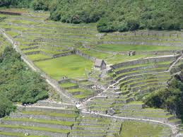
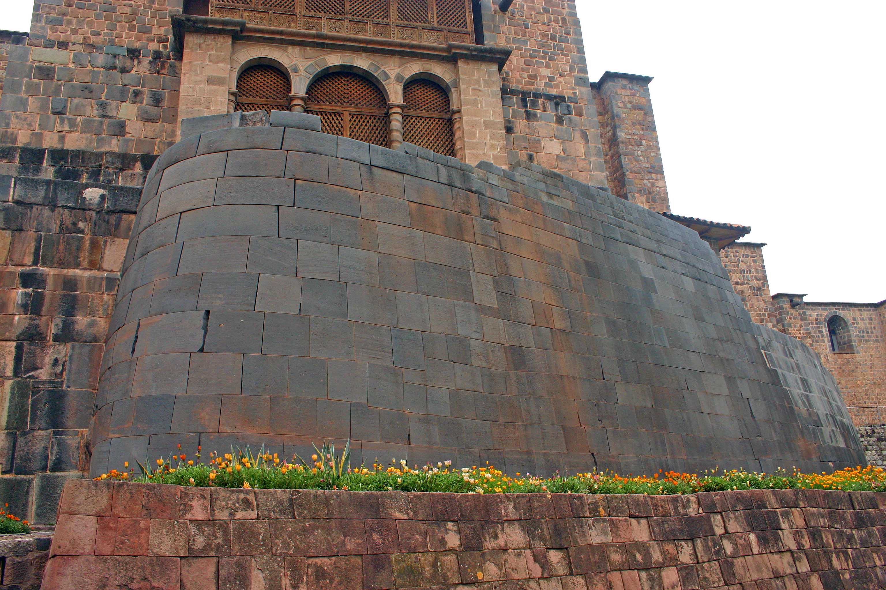
The taste of different potatoes varies broadly, explaining why these vegetables are used in all kind of dishes from appetizers to desserts. Peruvian potatoes date back to the massive Incan empire. In the Incan heyday in the 15th century, native farmers learned how to carve terraces out of steep hillsides of the Andes and adapt to the various climates of the region.
The highlands in Peru are generally considered to consist of two parallel ranges, the Cordillera Occidental and the Cordillera Oriental, extending in a northwest to southeast direction. The basins and valleys wedged high between the Peruvian Andes are intermont high level surface over which, historically, the majority of Peru's population has been concentrated.
Forest
The Amazon forest located in the eastern part of Peru has vast natural resources, but due to the lack of communication and transport infrastructure meant that this region wasn't exploited until the seventies. In 1973 began the extraction of oil on a large scale.
Mountains, plains, jungles, valleys, unique habitats and an extraordinary variety of eco-systems that shelter a wide diversity of plants and animals are part of the beautiful geography of Peru.
The Incas had an incredible system of roads. One road ran almost the entire length of the South American Pacific coast! Since the Incas lived in the Andes Mountains, the roads took great engineering and architectural skill to build. On the coast, the roads were not surfaced and were marked only by tree trunks.
More info on- Inca Government, Culture, Climate Weather,
|